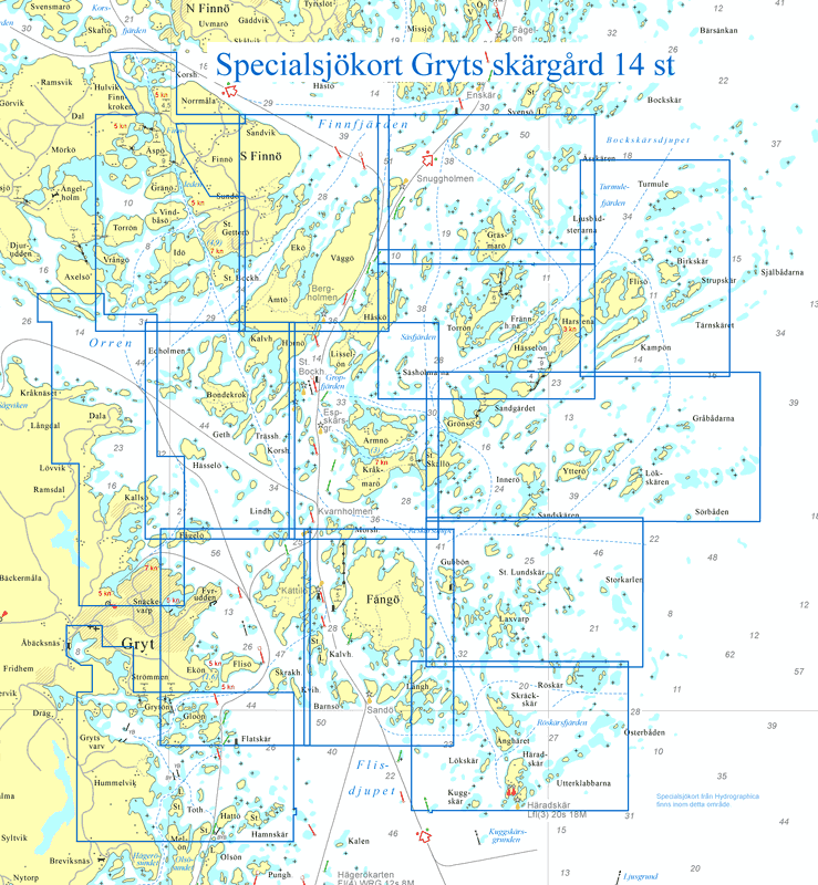
Paket med samtliga 14 stycken specialsjökort över Gryts skärgård. Följande sjökort ingår:
622-10 Södra Finnö
622-11 Väggö
622-12 Gräsmarö
622-13 Harstena
622-14 Birkskär
622-15 / 622-16 Orren / Snäckevarp
622-17 Bondekrok
622-18 Kråkmarö
622-19 / 622-20 Grönsö / Gråbådarna
622-21 Fyrudden
622-22 Fångö
622-23 Laxvarp
622-24 Häradskär
622-25 Hummelviksfjärden
Hydrographica’s special charts at a scale of 1:10,000 are made over difficult-to-navigate areas where official charts are insufficient. They contain significantly more and more accurate depth information, have detailed depth curves for 2 and 3 meters respectively and have elevation curves on land. The special nautical charts have a scale of 1:10,000 and are printed on Polyart, a synthetic, highly tear-resistant polyester material with a paper-like feel, made for boating use. The charts are completely waterproof and oil-resistant, writable, easy to wipe clean and they can be folded thousands of times without damage. But, like regular nautical charts, the material is affected and the colors fade if they are constantly exposed to sunlight.
Our products & charts
Order a chart with our interactive map to find the exact chart you are looking for.
Special charts
We are a global team of experienced Healthcare Professionals, MBAs, and Management Consultants. Schneider Consulting Group was founded in 2012 by Dr. med dent . Philipp
We are a global team of experienced Healthcare Professionals, MBAs, and Management Consultants. Schneider Consulting Group was founded in 2012 by Dr. med dent . Philipp
We are a global team of experienced Healthcare Professionals, MBAs, and Management Consultants. Schneider Consulting Group was founded in 2012 by Dr. med dent . Philipp