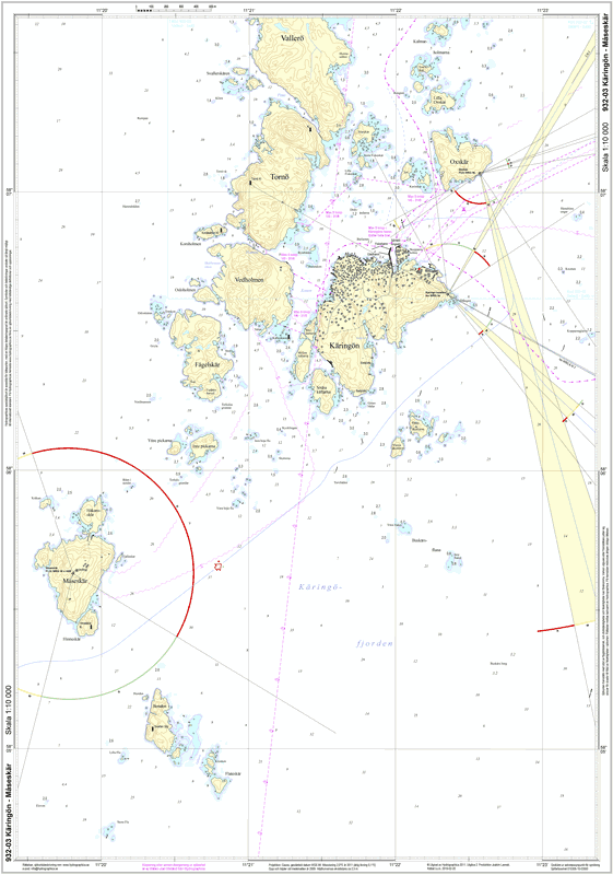
932-03 Käringön – Måseskär
SKU : S93203P
Special Chart | Format: A2 (42.0×59.4 cm) flat/unfolded | Scale 1:10,000
Hydrographica produces detailed special charts at a scale of 1:10,000 for difficult-to-navigate areas where official nautical charts are insufficient. They contain significantly more and more accurate depth data, featuring detailed depth contours for 2 and 3 meters respectively, as well as elevation contours on land. The special charts are at a scale of 1:10,000 and are printed on Polyart, a synthetic, highly tear-resistant polyester material with a paper feel, designed for marine use. The charts are completely waterproof and oil-resistant, writable, easy to wipe clean, and can be folded thousands of times without damage. However, as with standard charts, the material is affected and colors fade if they are constantly exposed to sunlight.