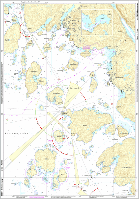
932-04 Kråksundsgap
SKU : S93204P
Special sea map | Format: A2 (42.0×59.4cm) plano/unfolded | Scale 1:10,000
Hydrographica produces detailed special charts at a scale of 1:10,000 over difficult-to-navigate areas where official charts are inadequate. They contain significantly more and more accurate depth information, have detailed depth curves for 2 and 3 meters respectively and have contour curves on land. The special charts have a scale of 1:10,000 and are printed on Polyart, a synthetic, very tear-resistant polyester material with a paper-like feel, made for boating use. The charts are completely waterproof and oil-resistant, writable, easy to wipe clean and they can be folded thousands of times without damage. However, as with regular charts, the material is affected and the colors fade if they are constantly exposed to sunlight.